The median home value in Beltsville, MD is $475,500.
This is
higher than
the county median home value of $369,000.
The national median home value is $308,980.
The average price of homes sold in Beltsville, MD is $475,500.
Approximately 55% of Beltsville homes are owned,
compared to 38% rented, while
7% are vacant.
Beltsville real estate listings include condos, townhomes, and single family homes for sale.
Commercial properties are also available.
If you like to see a property, contact Beltsville real estate agent to arrange a tour
today!
Learn more about Beltsville Real Estate.
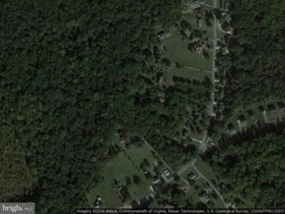
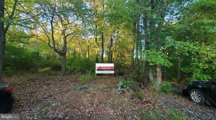
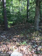
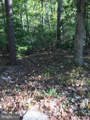
Do not miss this wonderful opportunity to live the dream of creating your custom home. This 2.44-acre lot located in Beltsville, Maryland has it all. Its proximity to the University of Maryland College Park, shopping, dining facilities, and the MARC Train makes for prime real estate. The ease of accessing major thoroughfares such as I95, BWI, Route 1, and Route 200. Makes for a manageable commute to Washington, DC, Baltimore, and Thurgood Marshall Airport. This wooded lot nestled well off Ellington Dr will provide a new homeowner tranquility and seclusion to retreat to daily. If this is what you have in mind this location is for you! Contact your agent and builder and let us get the process started today and get you in your beautiful new dream home.
Great location near community of already existing homes. Close to Costco, UMD, MVA, 495/295 etc. Buy and build your dream home!!!
Great location near community of already existing homes. Close to Costco, UMD, MVA, 495/295 etc. Buy and build your dream home!!!
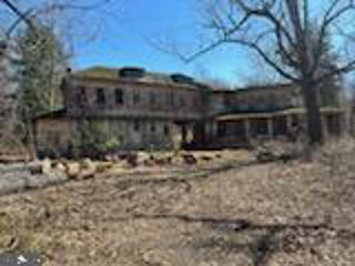
THIS IS A UNIQUE CORNER SITE COMPRISING A TOTAL OF 30 ACRES WITH ROAD FRONTAGE AND ADJOINING UTILITIES! IT CONSISTS OF A 17.98 ACRE TRACT IDENTIFIED AS PARCEL 35 ON TAX MAP 13 and 34 SINGLE-FAMILY RECORDED LOTS IDENTIFIED AS LOTS 1-34 IN BLOCKS "A" AND "B" OF THE OAKLODGE FARM ACRES SUBDIVISION (12 acres). THE POTENTIAL OF THIS COMBINED SITE AFFORDS A CONSIDERABLE NUMBER OF OPTIONS. WATER AND SEWER LINES FRONT THE PROPERTY ALONG AMMENDALE ROAD AND OLD BALTIMORE PIKE AS SHOWN WITH EXHIBITS IN THE DOCUMENT SECTION. THE SITE IS IN PROXIMITY TO THE MUIRKIRK RAIL TRAIN STATION (MARC) AND CONSIDERABLE NEW DEVELOPMENT IN THE AREA! Whether you start by utilizing the recorded lot development and subdivide the Parcel OR combine both tracts to maximize lot yield affords a tremendous profit potential! NOTE: The acreage piece has a deteriorated wasted asset comprising an old lodge of years past.
Owner has 10 lots total. This lot and the others are in an area that is an extension of an existing neighborhood. We believe that the sewer line was put in by the developer as there is evidence of two manhole covers where Rinard Ave would be placed.... No public water or electric in place however. Rinard Ave exists just on paper as a plan of where it would be placed.
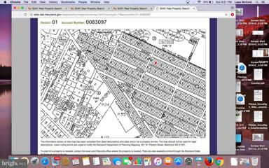
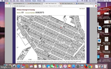
This is raw land.. If you go to SDAT acct identifier is 01-0083097 owner has 10 other lots in the development. Looks as if developer put in sewer system with the developed neighborhood next street over but not turned over to WSSC.
Owner has 10 lots total. This lot and the others are in an area that is an extension of an existing neighborhood. We believe that the sewer line was put in by the developer as there is evidence of two manhole covers where Rinard Ave would be placed.... No public water or electric in place however. Rinard Ave exists just on paper as a plan of where it would be placed.
This is a triple lot believed to be 60'X123'..... Lots 45, 46 & 47. We believe that the sewer line was put in by the developer as there is evidence of two manhole covers where Rinard Ave would be placed.... No public water or electric in place however. Rinard Ave exists just on paper as a plan of where it would be placed.
Owner has 10 lots total. This lot and the others are in an area that is an extension of an existing neighborhood. We believe that the sewer line was put in by the developer as there is evidence of two manhole covers where Rinard Ave would be placed.... No public water or electric in place however. Rinard Ave exists just on paper as a plan of where it would be placed.
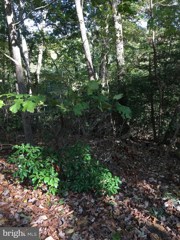
This is raw land... Highview comes off of Quimby by Rt 1 then ends... This is in an area of woods where there would be an extension of the existing neighborhood. We believe that the sewer line was put in by the developer as there is evidence of two manhole covers where Rinard Ave would be placed.... No public water or electric in place however. Highview Ave exists just on paper as a plan of where it would be placed.
This is raw land... Highview comes off of Quimby by Rt 1 then ends... This is in an area of woods where there would be an extension of the existing neighborhood. We believe that the sewer line was put in by the developer as there is evidence of two manhole covers where Rinard Ave would be placed.... No public water or electric in place however. Highview Ave exists just on paper as a plan of where it would be placed.
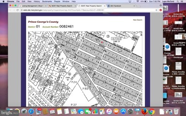
This is raw land.. If you go to SDAT acct identifier is 01-0082461 owner has 11 other lots in the development
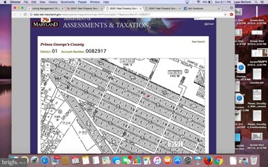
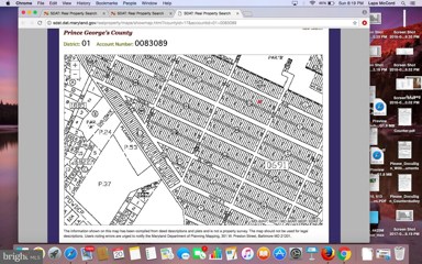
This is raw land.. If you go to SDAT acct identifier is 01-0082917 owner has 11 other lots in the development
This is raw land.. owner has 10 other lots in the development We believe that the sewer line was put in by the developer as there is evidence of two manhole covers where Rinard Ave would be placed.... No public water or electric in place however. Rinard Ave exists just on paper as a plan of where it would be placed.
Owner has 10 lots total. This lot and the others are in an area that is an extension of an existing neighborhood. We believe that the sewer line was put in by the developer as there is evidence of two manhole covers where Rinard Ave would be placed.... No public water or electric in place however. Rinard Ave exists just on paper as a plan of where it would be placed.
Copyright © 2024 Bright MLS Inc. ![]()
![]()
Website designed by Constellation1, a division of Constellation Web Solutions, Inc.